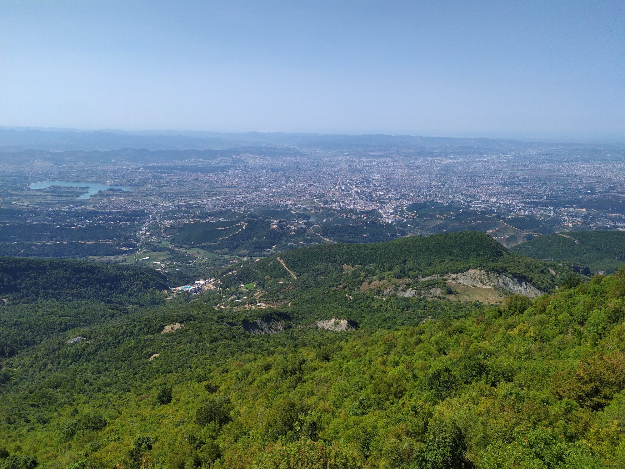
Tirana sits in a bowl. Stand anywhere on the boulevard, look east past the ministries, and there is a grey-green wall of mountain closing off the sky. Most visitors spend three days in this city, photograph the painted buildings, drink a great deal of coffee, and never once walk up into it.
That is a shame, because the hiking within an hour of Tirana is genuinely good. Not Alps good. You will not get the Valbona pass or the Accursed Mountains here. But you can be on a limestone ridge with the whole city laid out below you by ten in the morning and back in Blloku for dinner, and for a city of this size that is unusual.
What follows are six walks I have done repeatedly, ordered roughly from easiest to reach to hardest. I have been honest about transport, because that is where most guides quietly lie to you.

What “Near Tirana” Actually Means
A word on distance before you start planning. Albanian road distances are a poor guide to Albanian travel times. Twenty five kilometres northeast of the city can mean an hour and ten minutes, because the last stretch is unpaved and you will be behind a truck for most of it.
The other thing worth understanding early: only two of these six are properly reachable by public transport. Tirana’s municipal buses are cheap and frequent, but they stop where the city stops. Beyond that you are into furgon (minibus) territory, and furgons serve villages, not trailheads.
If you have a car, all six are easy. If you do not, renting one for a day or two solves most of this list. The local agencies on Localrent start at around 25 euros a day for a small car and will usually bring it to your accommodation. Otherwise read the transport notes carefully and consider that a shared tour to Bovilla, at roughly 20 euros, sometimes costs less than the taxi.
1. Mount Dajti: The Ridge Above the City
This is the obvious one, and it deserves its reputation. Dajti is the mountain you have been looking at from the boulevard all week. Its highest point, Maja e Dajtit, reaches 1,613 metres. The neighbouring summit, Maja e Tujanit, sits at 1,531 metres and is the one most people actually walk to.
The cable car, Dajti Ekspres, is the reason this hike is so accessible. It climbs the western flank in about fifteen minutes and leaves you well up the mountain, on a broad shoulder with restaurants, a small adventure park, and a genuinely absurd number of families eating lunch. From there the real walking starts.
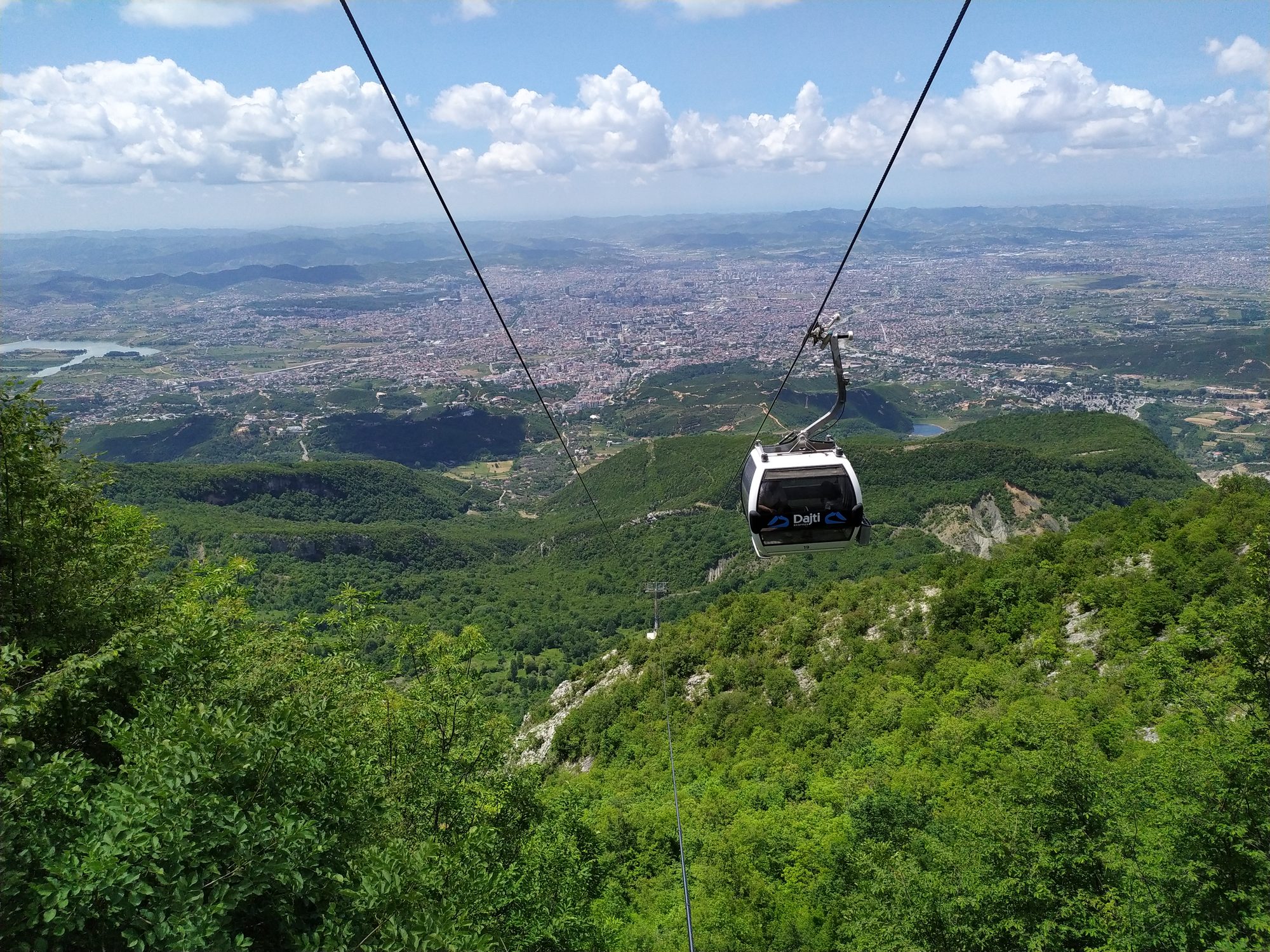

Walk east away from the restaurant terraces and within ten minutes the crowds thin out completely. The trail climbs through beech and then opens onto grassland along the ridge. Allow around an hour and a half to Maja e Tujanit, a little more if you stop, which you will. The path is obvious in good weather and marked well enough.
The honest version: the summit is not dramatic. It is a rounded grassy top with a trig point and some litter. What is dramatic is the walk along the ridge to reach it, with Tirana falling away on one side and the empty interior mountains on the other.
Getting there: take the municipal bus marked Porcelan from near the Clock Tower in the centre, around 40 lekë, then walk about ten minutes uphill to the lower cable car station. The cable car costs somewhere around 1,500 lekë return, roughly 15 euros, with a cheaper one way option if you intend to walk down, and it rests on Tuesdays. Prices have crept up steadily, so treat that as a guide and not a promise.
Time: three to four hours of walking from the top station, plus transport. A comfortable half day.
2. Bovilla Lake and Maja e Gamtit
If you have seen one photograph of Albania on Instagram in the last three years, there is a fair chance it was this: a turquoise reservoir wedged between limestone walls, shot from a rock spur directly above it.
Bovilla is Tirana’s drinking water supply, about 25 kilometres northeast of the city on the far side of the Dajti massif. The viewpoint everyone photographs is Maja e Gamtit, and the walk up to it from the parking area is short. Genuinely short. Around thirty to forty minutes, with a stone path giving way to bare rock, and iron steps with a handrail on the final scramble.
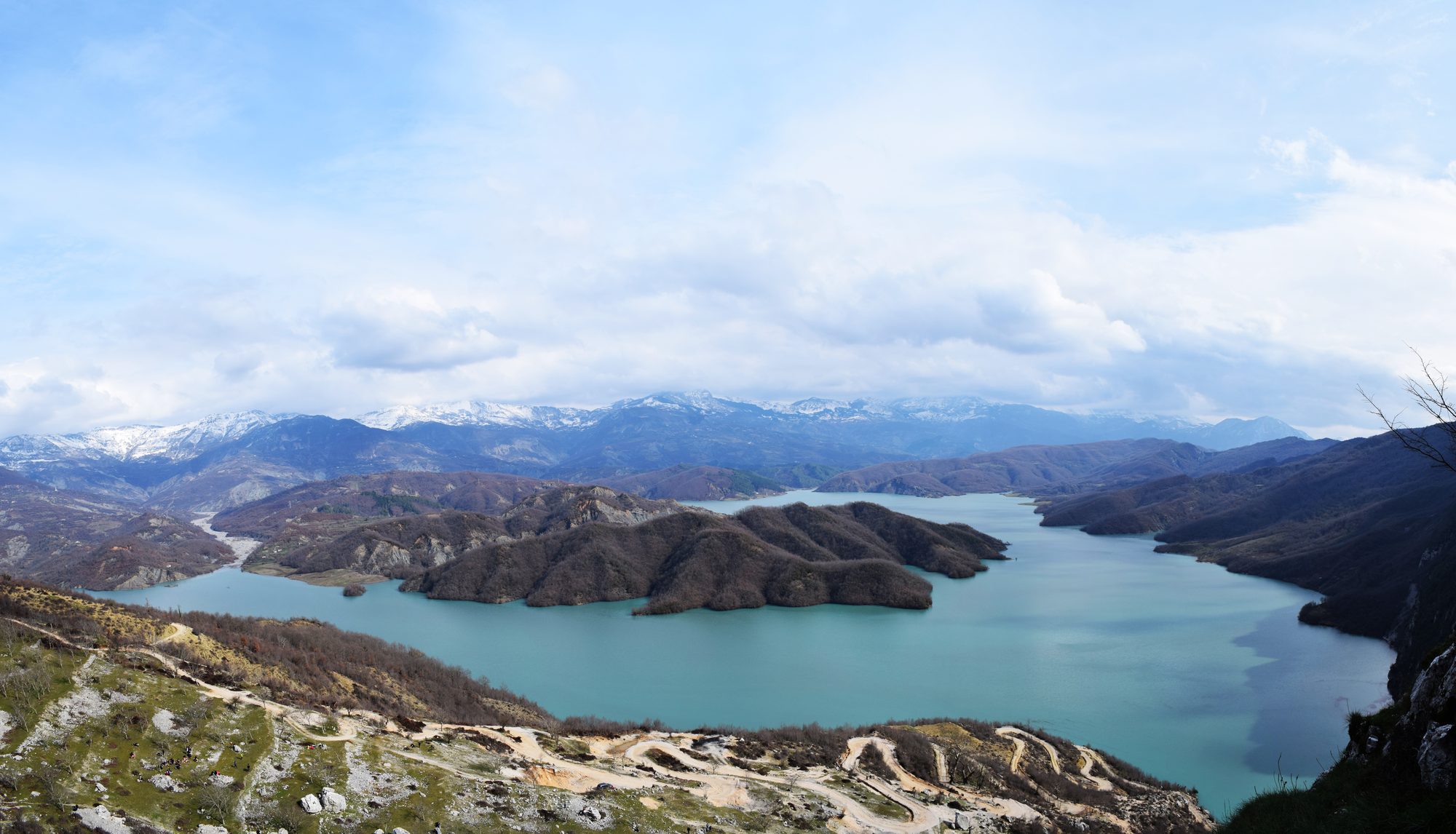

Do not let the short walking time fool you into treating this casually. The final section is exposed, the rock is polished smooth by thousands of trainers, and it is genuinely unpleasant when wet. I have watched people go up there in sandals. Do not be those people.
Getting there: this is the one with no public transport answer. The road from Tirana runs through Zall Herr and then deteriorates into a rough unpaved track for the last several kilometres. Ordinary rental cars do make it, slowly, but you will not enjoy it. A shared minibus tour from Tirana runs around 20 euros including pickup, and honestly it is the sensible choice.
Time: about an hour each way from the city, an hour and a half on the hill.
3. Pëllumbas Cave and the Erzen Canyon
My favourite of the six, and the one fewest visitors do.
The village of Pëllumbas lies roughly 27 kilometres southeast of Tirana, past Petrela, in a landscape that feels much further from the city than it is. From the village a well built trail contours up the flank of the gorge for about forty minutes to Shpella e Zezë, the Black Cave.
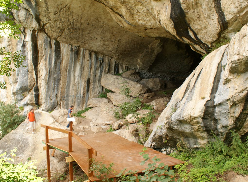

The cave itself is properly dark and properly deep, with stalactites and a resident bat population that will make itself known. Go in far enough that the daylight behind you becomes a small blue shape, then turn your torch off for a moment. It is worth doing.
The better half of the day is below. Drop down from the village into the Erzen canyon, where the river runs through a series of clear green pools between rock slabs. In July and August people swim here. The water comes off limestone and it is cold enough to hurt, in the good way.
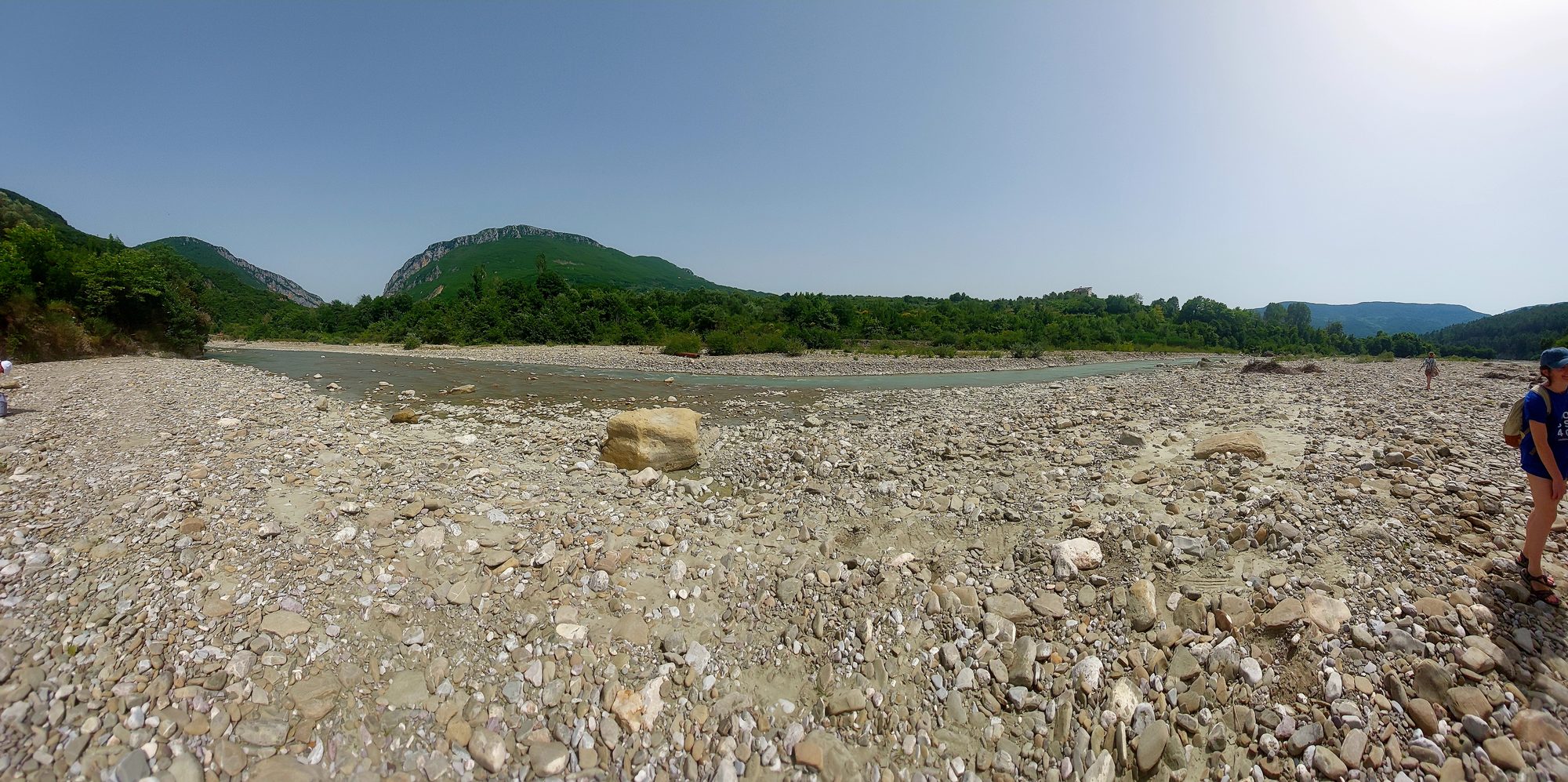

Getting there: furgons run from Tirana toward Pëllumbas village, though timings are informal and thin out badly in the afternoon. Ask at the terminal near the Zoo or check with your guesthouse the day before. Driving takes about forty minutes. If you go by furgon, establish how you are getting back before you commit to the day.
Time: three to four hours including the cave, longer if you swim.
4. Petrela Castle: The Short One
Not really a hike. Include it anyway, because it pairs perfectly with Pëllumbas and because it is the right answer when you have half a day and no ambition.
Petrela sits on a rock spur about 15 kilometres south of Tirana, a fortress with foundations going back to the sixth century and a commanding view down the Erzen valley. The walk up from the village car park takes fifteen minutes. There is a restaurant inside the walls with a terrace that has one of the better views near the city.
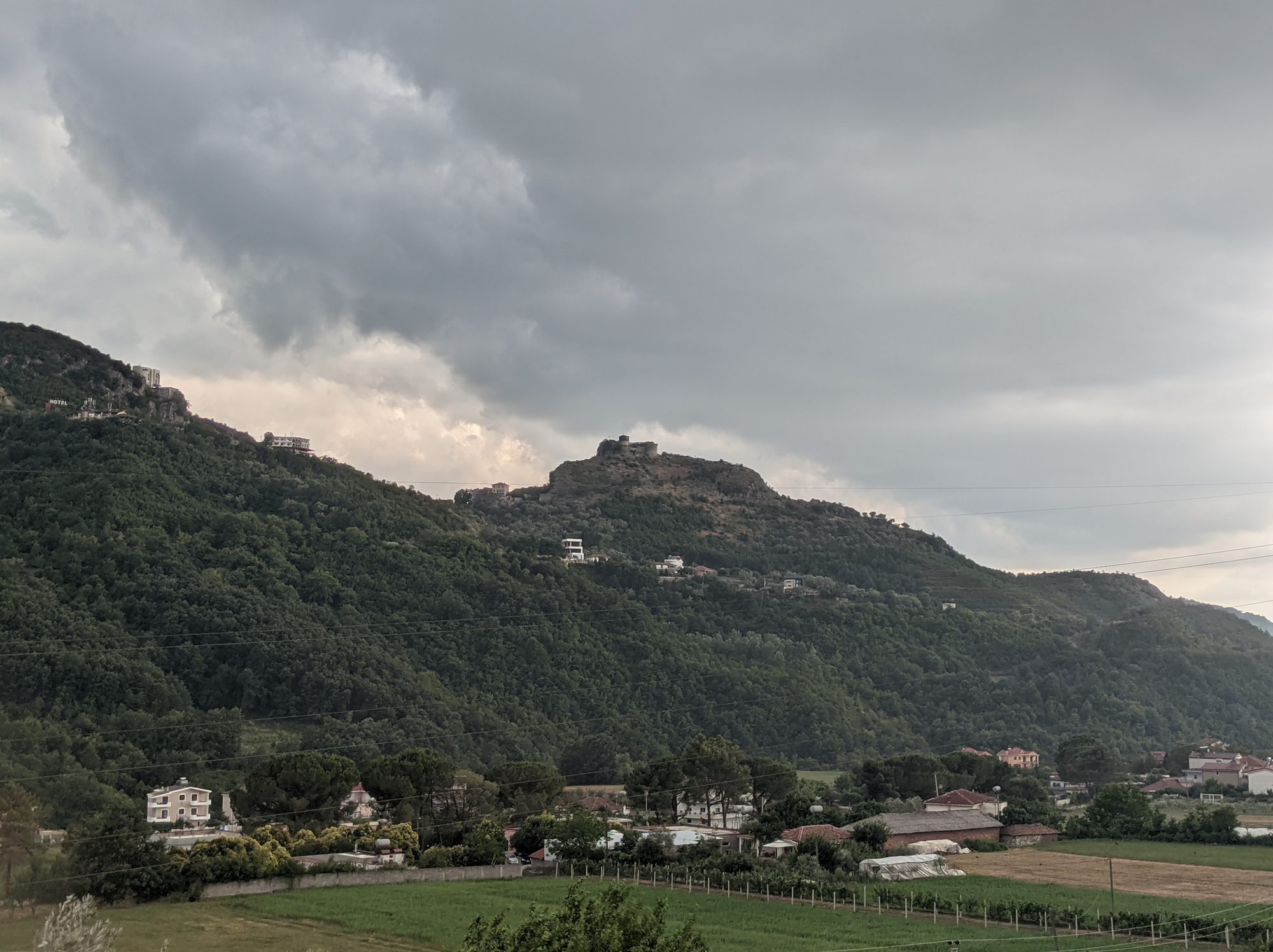

Getting there: furgons toward Petrela from central Tirana, or about 25 minutes by car. Combine it with Pëllumbas in a single day, since they are on the same road.
5. Mali me Gropa: The Weird One
Mali me Gropa translates as “the mountain with holes”, and it is exactly that. A high limestone plateau riddled with sinkholes and dolines, about an hour’s drive northeast of Tirana through Qafë Mollë, the Apple Pass, on the old road toward Shëngjergj.
This is karst country at its strangest. The ground is pocked with depressions, some of them tens of metres across, and there is almost no surface water because it all drains straight down through the rock. Shepherds bring flocks up here in summer. Otherwise it is empty.
There is no single defined route, which is both the appeal and the problem. Bring a map. OsmAnd or Wikiloc both have usable tracks downloaded in advance, and you should download them in advance, because the signal up there is unreliable.
Nearby, the village of Shëngjergj has a small waterfall a short walk from the road. It makes a good second stop.
Getting there: car, realistically. The road over Qafë Mollë is paved but narrow and slow.
Time: a full day.
6. The Grand Park and Farka Lake: When You Have Three Hours
Not a mountain, and I am including it deliberately.
Parku i Madh, the Grand Park, covers 289 hectares on the southern edge of the city around an artificial lake. A full circuit of the lake takes about an hour and a half at a strolling pace. On a Sunday morning it is the whole of Tirana out walking at once, which is its own kind of sightseeing.
If you want to extend it, carry on east to Farka Lake, roughly 8 kilometres from the centre, which has a pedestrian promenade around most of its shoreline and a fraction of the crowds. This is where Tirana goes to walk when the Grand Park is too busy.
It is flat, it is easy, and after four days of driving mountain roads it is exactly what you will want.
Getting there: walk from Blloku to the Grand Park in twenty minutes. City buses run out toward Farka.
Best Time to Go
Spring, April to early June, is the best window. The limestone is green, the Erzen is running, wildflowers are out on the Dajti ridge, and you are not yet cooking. This is when Bovilla is at its most intensely blue.
Autumn, late September through October, is nearly as good and often clearer. The beech woods on Dajti turn properly, and the summer haze that flattens the view over Tirana has usually broken by then.
Summer is hot and hazy. Not impossible, but start early. On the Dajti ridge and the Gamti spur there is essentially no shade, and by eleven in the morning in July it is unpleasant. Compensation: the Erzen pools are at their best.
Winter can be superb, with caveats. The clearest views of the year come after winter rain. Dajti gets snow above 1,200 metres and the ridge can be genuinely icy. Bovilla’s access track becomes a mud problem.
Practical Tips
Download offline maps before you leave the city. Coverage on Dajti is fine and coverage almost everywhere else is not. OsmAnd and Wikiloc both work well for this region. If you are on roaming, remember Albania sits outside the EU cap; an Albanian eSIM (Airalo has them from a few euros) makes the data question go away for the whole trip.
Shepherd dogs are real and you will meet them. They guard flocks and they take the job seriously. Stop moving, do not run, do not turn your back, let them come and assess you, and wait for the shepherd. Picking up a stone is understood as a threat by both dog and shepherd. There is more on this in our first-timer’s guide to hiking in Albania.
Carry all your water. There are no reliable springs on the Dajti ridge, on Gamti, or on the Mali me Gropa plateau, which drains internally by definition. Two litres per person in summer.
Bring cash in lekë. The cable car takes cards. Village cafés, furgon drivers, and the restaurant at Petrela largely do not.
Sundays are busy, weekdays are empty. Dajti in particular transforms. If you want the ridge to yourself, go midweek, though not on a Tuesday, when the cable car takes its day off.
One Last Thing
The thing I keep coming back to about Dajti is how completely the city disappears. You climb for forty minutes from a cable car station full of families eating grilled meat, come over the shoulder of the ridge, and Tirana is simply gone behind you. In its place, a hundred kilometres of empty green mountain running east toward Macedonia with almost nothing in it.
Then you turn around and there it is again, half a million people in a bowl, close enough that you can see the traffic on the ring road.
It takes about an hour to get there from a café on the boulevard. Not many capitals give you that.
If these leave you wanting something bigger, the Valbona to Theth crossing in the northern Alps is the natural next step, and our guide to Albania’s best hiking trails covers the rest of the country.